4 Ways to Reveal Partner Cheating Using Technology
Your gut picks up your partner might be cheating? Forget about lipstick on the collar. Modern technology has made infidelity easier to expose. Smartphones, tablets, PCs absorb adulterous evidence like a sponge. And if suspicions are aroused, you can follow a digital trail that can provide many clues. Let’s find out how.


Tech ways to catch a cheating spouse
It’s rather easy to reveal a cheating partner today. But before we move on to the know-how, let’s clear up one thing first — it’s not OK to invade the privacy of anybody even if it’s your spouse. The best thing you can do is have a frank and honest conversation with them. Honesty is the best policy, and sometimes it can work wonders. However, if this somehow is not the option for you, here are basic methods for busting a cheater.
Location history
We become more and more reliant on GPS. So, peeking at your spouse’s location history may reveal something. For Android users, there are Google Timeline featured in the Google Maps app (click the profile photo) or Google Maps online if they are logged in. The two function similarly. However, you should note that every month Google reminds its users abouComputer browsing and download history and temp files t location data collection. So, those who want to hide their movements could go back and delete their location history even with location data turned on.
Meanwhile Apple has the following tracking gem. Find your spouse’s frequent locations in Settings > Privacy & Security > Location Services > System Services > Significant Locations. You can then select a specific location to view a detailed map. Most people don’t realize this feature exists. So, if they take it as far as to disable or delete these types of settings, they may be up to no good.
Finding an Apple device
If you and your spouse have a family account to share, you can access the information on your spouse’s iPhone,including their location. It’s possible via the Find My app if your spouse enabled location sharing. This way, you can locate their device by logging on iCloud.com and clicking on Find My iPhone or by using the Find My Friends app. However, you may not see the device’s precise location if Precise Location has been turned off for Find My.
Finding an Android device
Your spouse is using an Android-powered phone? If they are logged into Google on a shared computer, you can go to Google’s Find My Device to see the phone’s location. Often, family members don’t bother to log out. To check which account is logged in, see the picture in the upper right corner of the Google search page.
Computer browsing and download history and temp files
This is also a rather obvious way. And an effective one if your partner has not been covering their tracks. The browsing history can help you out if your partner’s story doesn’t seem to add up — especially if they routinely access dating sites or adult platforms you never knew about. For example, a hotel’s name comes up when they tell you they’re staying at their friend’s.
Besides, recording your browser history (which can be easily deleted), your browser keeps temporary files. They are used to cache web pages and multimedia content, such as video and audio or picture file types. And your spouse may have disregarded them. Most browsers store temp files on your hard drive. For example, if you use Chrome, go to the “Users” folder on your system hard drive and open the folder for your username. From there, go with “AppData\Local\Google\Chrome\User Data\Default\Cache” and check for anything suspicious.
You can also check the browser download history. If it’s not cleared, you can find a list of downloaded files (deleted ones, as well, that can be found in the computer’s recycling bin).
Incriminating apps and features
Using some apps and their features can be a red flag, as well. For example, Snapchat is a great app to keep in touch. But it’s also great for covering one’s tracks — especially hook up services that thrive on temporary messages. So, the app lets you temporarily share text messages, photos, and videos. It can provide some tell-tale signs of cheating on phone. For example:
- Your spouse has a long Snap Streak with a person you don’t know. A Snap Streak is when two users send videos or photos to each other every day for at least three days in a row — and if one of them isn’t you, they might be talking to the wrong person.
- The Snapchat Map. It lets users find out where any of their friends are at the moment. But you can only see a person’s location if they have allowed you to. Your partner is wandering around a place unfamiliar to you? That might not be for good.
Another way is via Facebook Messenger. There you can see if your partner has any Secret Conversations, which lets one have a closed-off encrypted chat with secret messages hidden from the standard inbox.To see Secret Conversations:
- Open Facebook Messenger.
- In the top left, click on the profile — it’ll take you to the menu.
- Scroll down to see Secret Conversations.
- Hit that button to see all secret conversations, if there are any.
Scanning digital receipts
Most people don’t leave a physical trail when buying something, but there is often a virtual one. You can check your partner’s messages or emails to see if there are any digital receipts for products and services you’ve never heard of your partner use or go to, like hotels, restaurants, jewelry stores.
Revealing a cheating spouse via tech or privacy invasion?
Exposing a cheater has become easier with technology, yes — especially when they rely on a hidden or locked phone to keep things private. But here’s the thing. Electronic snooping is the least-healthy way to confirm (or get rid of) cheating suspicions. It’s better to go for it only as a last resort. In fact, infringing on your partner’s privacy can cause even more damage.
So before spying on your spouse via tech, keep in mind that intercepting private electronic communications without permission is a violation of both federal and state wiretapping laws. Your spouse can even sue you for the invasion of privacy. Depending on the nature and extent of this intrusion and the actual damages suffered, a “spy” could be forced to pay a fine. Also, such snooping could be taken against them if the pair decided to take things to court in their divorce proceedings.
So yeah, online privacy has become more of a privilege. Often people take extra measures to protect it. But when they do, it doesn’t necessarily mean they’ve got something to hide. There are many tools for data protection online, and a Virtual Private Network (VPN) is one of them. Let’s get to some details.
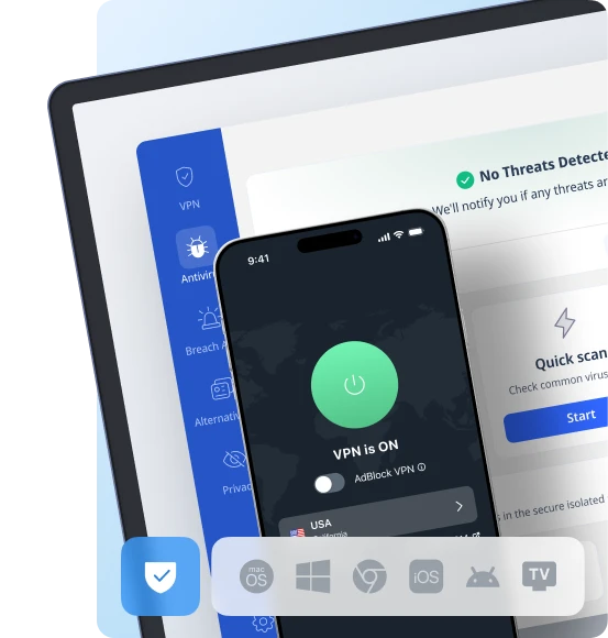
How to protect privacy online with VeePN
Imagine a tunnel, driving through which you’re not seen to the outside eye. A VPN is the service that sends all your data through a so-called virtual tunnel to a VPN server. With this, it keeps your personal info under wraps from third parties. On the way, the service encrypts the data and changes your IP address — your “home address” online. This boosts your anonymity and security while on the web.
VeePN is one such service created to protect people’s online privacy and security. With 2,500+ servers in 89 locations and next-gen encryption, it guards your data even on the most vulnerable public networks. All because VeePN respects your right to privacy. As everyone should.
FAQ
How to check your partner’s phone for cheating?
Electronic snooping is the least-healthy way to confirm cheating suspicions. It’s better to go for it only as a last resort. But if it’s not the option for you, some basic methods for busting a cheater are through a location history, browsing and download history, digital receipts, and incriminating apps and features. Learn more in this article.
VeePN is freedom
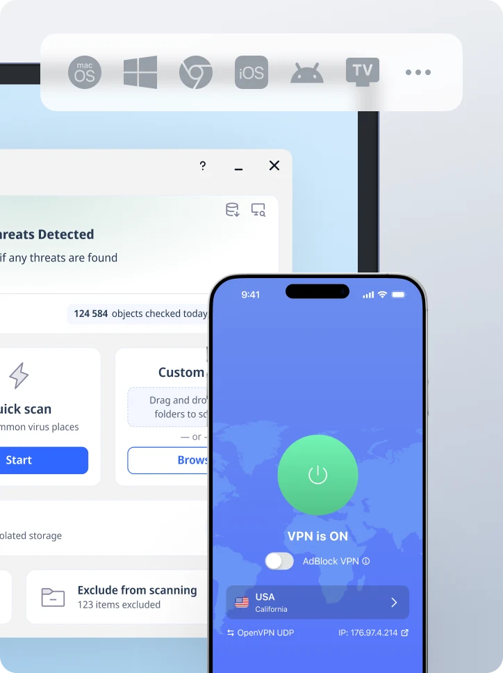
Download VeePN Client for All Platforms
Enjoy a smooth VPN experience anywhere, anytime. No matter the device you have — phone or laptop, tablet or router — VeePN’s next-gen data protection and ultra-fast speeds will cover all of them.
Download for PC Download for Mac IOS and Android App
Want secure browsing while reading this?
See the difference for yourself - Try VeePN PRO for 3-days for $1, no risk, no pressure.
Start My $1 TrialThen VeePN PRO 1-year plan